Simply navigate England’s Waterways
Simplifying Navigation Across England’s Waterways
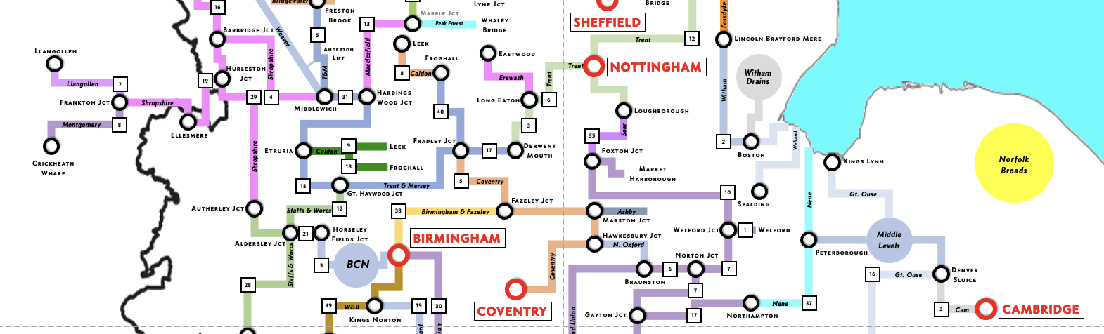
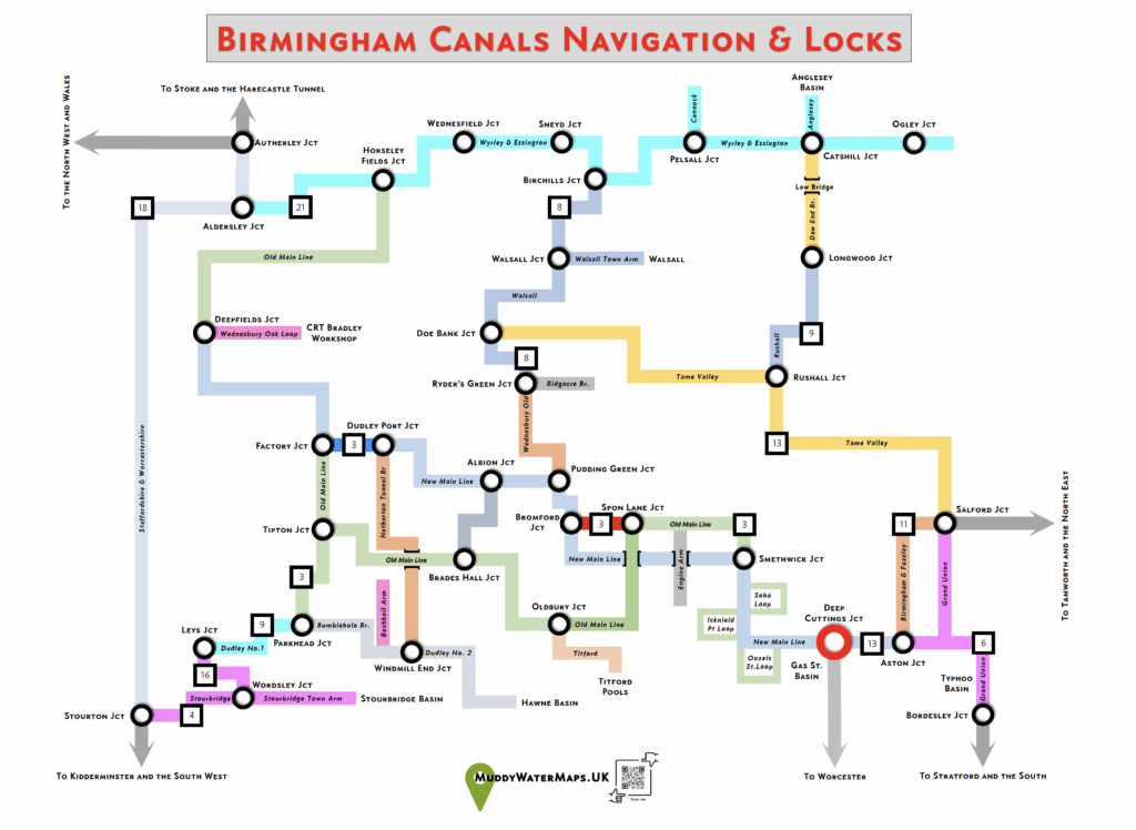
Discover England’s Waterways at a Glance
MuddyWaterMaps is dedicated to simplifying your canal and river adventures, offering clear and accessible maps to help you explore England’s waterways with ease.
Discover England’s Waterways with Ease
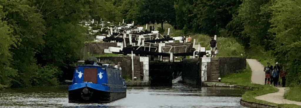
No need to become a map expert, just “follow the pointy end” of your boat and enjoy the scenery, knowing that you are sure to get to your destination.

MuddyWaterMaps made my canal trip seamless and fun—an absolute must for waterway explorers!
Toni Booker
Experienced Narrowboater
The map showed some great waterside hostelries, whose ales and food I thoroughly tested.
Richard Terry
Batchelor Party Organiser
I couldn’t be happier with the intuitive maps, which cover all the main waterways and navigable rings.
Jim Dahm
Waterways Guide Specialist
Seamless Navigation for Waterway Explorers
Quickly discover the highlights of our service.
Multiple Options
Enjoy 12 different aspects of England’s waterways
Custom Routes
Make a souvenir of your canal holiday by requesting customised features in your map.
Print Options
Available as A4 paper maps, 45x75cm tea towels, scarves and aprons.
Community Insights
Maps with waterside pubs and sightseeing suggestions for all the family
Not just a map
Printed on high quality tea towels for polishing your glassware after celebrating your canal journey.
Discover England’s Waterways with Ease
How many locks before we can rest for the night? MuddyWaterMaps will tell you, and give ideas for alternative routes and stopping points.

How can I use MuddyWaterMaps to plan my journey?
Our maps show simplified routes to help you explore England’s waterways quickly – no need to become an expert!
Where can I get MuddyWaterMaps?
Direct from our online Contrado Store, from your boat hire company, or
for custom designs, by emailing us at muddywatermaps@proton.me
Buy from us direct and save on postage at these marina open days in Summer 2025 —
WIGRAMS TURN MARINA —– 17TH MAY —–
WHITE MILLS MARINA —– 8TH JUNE —–
What waterways does MuddyWaterMaps cover?
We cover all navigable waterways across England, including canals and rivers.

Printed Waterway Maps from as little as £5
Paper based maps from £5, tea towel and other options from £20
Customized Routes
Ask us to add your unique memories to a map and deliver a special souvenir of happy times on the water.
Points of Interest
Uncover landmarks, dining spots, and hidden treasures along the waterways.